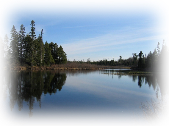
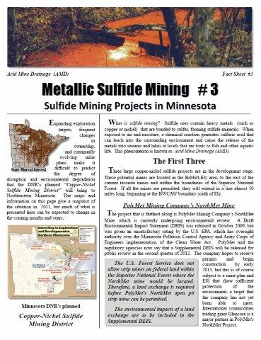
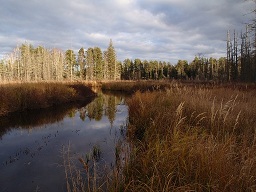
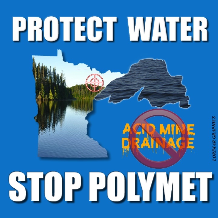
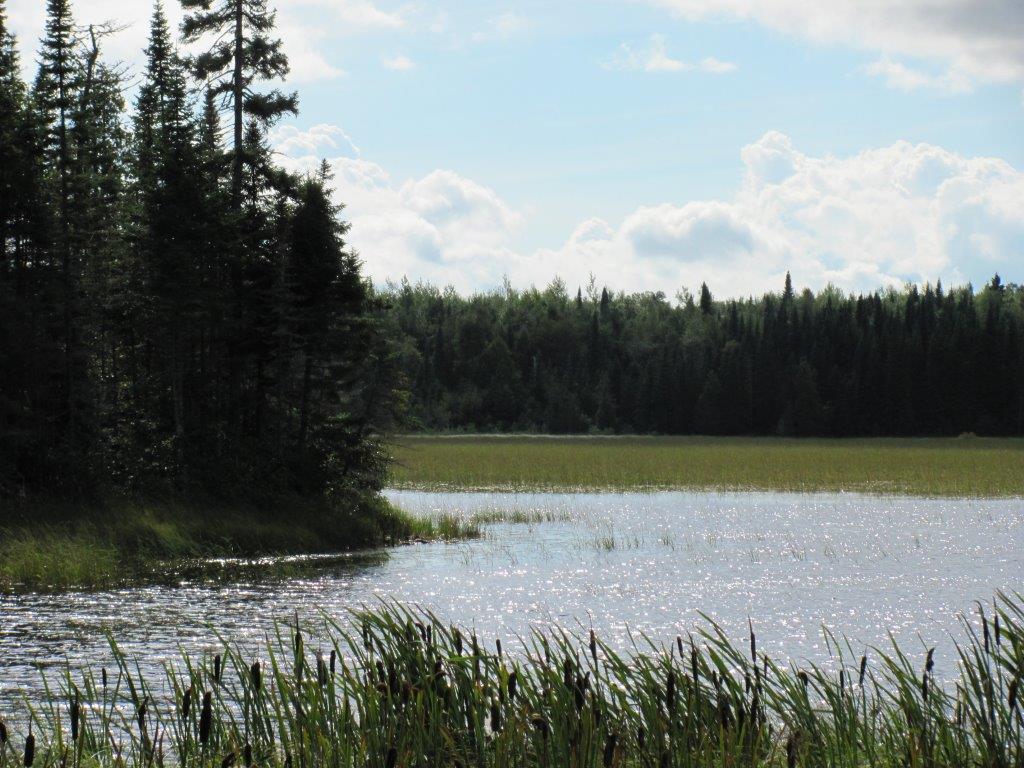
Located between the North Shore of Lake Superior and the Boundary Waters Canoe Area Wilderness, the Arrowhead Region is Minnesota's most loved recreation area and a place that millions visit for rejuvenation. This region faces an unprecedented industrial expansion that is certain to affect the qualities that draw people here. One of the worst threats from this expansion is from the mining of sulfide ores, a particularly harmful type of mining that has not been conducted in Minnesota before. PolyMet Mining's NorthMet Mine, located between Babbitt and Hoyt Lakes, is the first of what may become many sulfide mine proposals. Found HERE
 Acid Mine Drainage, PA-DEP
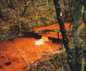
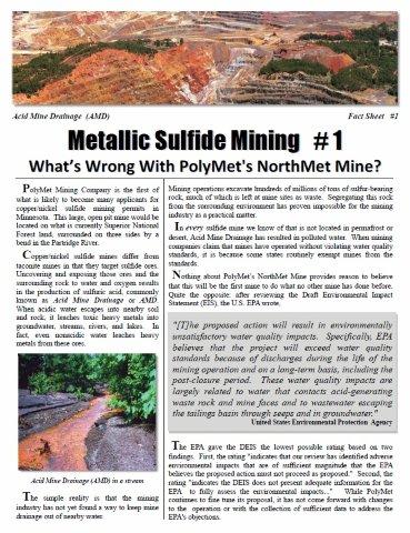
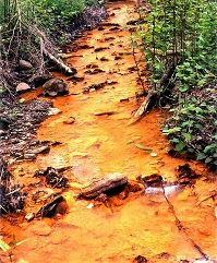
Sulfide ores are ores containing heavy metals (such as copper or nickel) that are bonded to sulfur, forming sulfide minerals. When exposed to air and moisture, a chemical reaction generates sulfuric acid that can leach into the surrounding environment and cause the release of the metals into streams and lakes at levels that are toxic to fish and other aquatic life. (See Video) This phenomenon is known as Acid Mine Drainage. In a surface mine like the one proposed by PolyMet, mining leaves huge piles of waste rock and a huge pit exposed to the elements. Like the ore that has been removed, the waste rock and the pit walls contain sulfide minerals. The potential for Acid Mine Drainage and for contamination of surface and ground water by heavy metals remains for centuries, and even millennia, into the future.
Click image - Explore Minnesota: Minerals MN Has Excellent Mineral Potential
(1) PolyMet (2) Track Record
(3) Projects (4) MN Mining
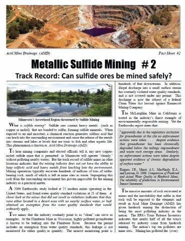
Acid Mine Drainage has already polluted more than 12,000 miles of rivers and streams and over 180,000 acres of lakes and impoundments in the United States. According to the U.S. EPA, acid mine drainage from coal mining is the leading source of water pollution in the Mid-Atlantic States. Acid Mine Drainage from metal mines in Western states has caused some of the country's largest and most contaminated Superfund sites. Mining companies argue that modern mining methods can protect against Acid Mine Drainage, but they cannot point to a single mine that is more than a few years old that has not resulted in contamination. Because Acid Mine Drainage often takes several years to develop, recent mines that have not yet contaminated nearby waters do not provide proof that these ores can be mined safely.
![]()
Click image to see:
"NORTHEASTERN MINNESOTA'S ARROWHEAD REGION THREATENED BY SULFIDE MINING AND INDUSTRIALIZATION" pamphlet
State Mineral Lease Map
Click on image to enlarge
Click on image below to see larger view of "Minnesota State Mineral Ownership" DNR

MN DNR Metallic minerals lease sale
Natural Resources Research Institute (NRRI)
Iron Range Resources and Rehabilitation Board
PolyMet Mining (Glencore controlled)
Glencore International AG (controls PolyMet)
Cleveland Cliffs, Inc. (various deals)
Kennecott Exploration (Rio Tinto)
Talon Metals (Kennecott JV in MN)
Teck Resources (Mesaba Project)
Lehmann Exploration, Inc (Franconia)
Beaver Bay Joint Venture ("BBJV"), North Central Mineral Ventures (Franconia)
Duluth Metals (Acquired by Antofagasta)
Antofagasta (Twin Metals parent)
AngloGold Ashanti Minnesota Inc.
WMC Exploration Inc (BHP Billiton)
Rainy River Resources Ltd (608457 B.C. LTD)
RENDRAG; Gardner Management Services Inc (Yawkey Minerals Management LLC)
Superior Mineral Resources LLC
Minerals Processing Corporation (Aquila)
RGGS Land and Minerals Ltd (PolyMet Leases)
BARR Engineering-mining facilitators
*Note - Above is a partial list of those interested in Minnesota's metallic sulfide mineral potential

Click on image to see larger view of the "Duluth Complex" DNR
Minnesota's Mineral Lands Statutes
MN Administrative Rules CHAPTER 6132 NON-FERROUS METALLIC MINERAL MINING
Mineral Rights Ownership in Minnesota
Public Land and Mineral Ownership in MN
2007 Minnesota Mining Tax Guide
State Owned Lands In MN by Land Type Map
Governor's Committee on MN's Mining Future
Governor's Committee on MN's Mining Future update - October 2008
Minnesota DNR Lands & Minerals: Publications
Iron Range, Cities and Towns - Macalester
Index to the Minnesota Regional Copper-Nickel Study (5 MB)
Volume 1: Executive Summary 1976 (large file 8 MB)
Volume 3 - Chapter 4: Water Resources (very large file 24 MB)
Volume 3 - Chapter 5: Noise in the Environment (4 MB)
Volume 4 - Chapter 1: Aquatic Biology Resources (large file 11 MB)
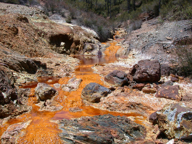
Click on image to see larger view of Acid Mine Drainage in the Rio Tinto River (Spain)
ARSENIC AND CADMIUM PRESENCE IN AMD-AFFECTED RIVER WATERS
Environmental impact of mining activities in the Odiel river basin (SW Spain)
ABANDONED MINES Problems, Issues and Policy Challenges for Decision Makers-UN
The Earth's Open Wounds: Abandoned and Orphaned Mines
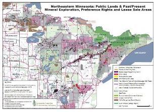
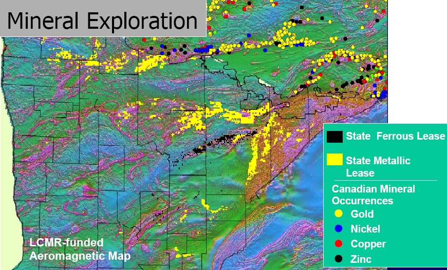
Click on image to see larger view of Minnesota Center for Environmental Advocacy's (MCEA) Mineral Exploration Map of Northeastern Minnesota
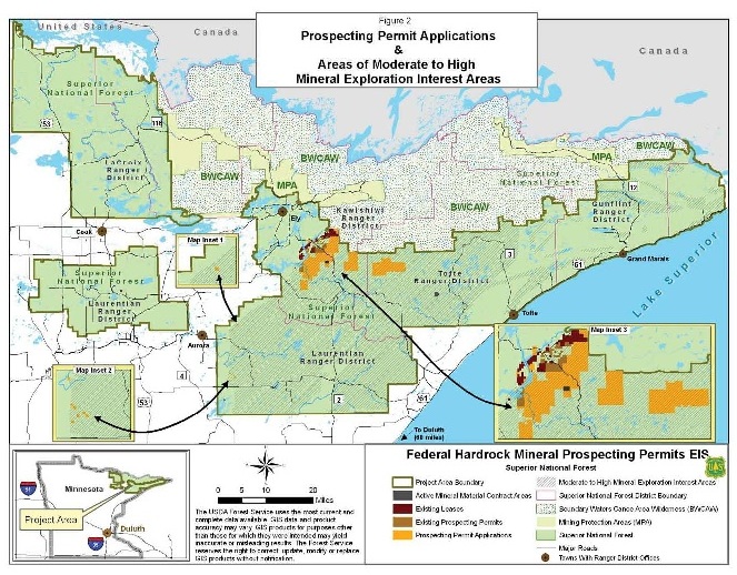
Click on image to see: USFS Hardrock Mineral Exploration in the Superior National Forest
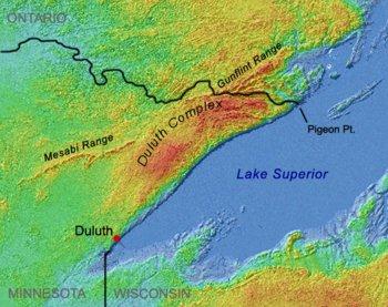
Duluth Complex of Northeastern Minnesota
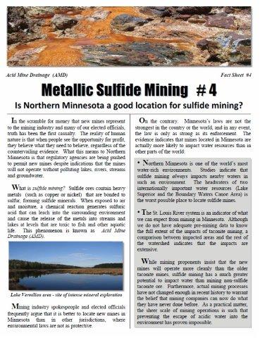
Extensive and advanced exploration for copper-nickel sulfide mineralization is occurring throughout Minnesota's Arrowhead Region, as well as other parts of the state. Sulfide mining, if allowed, would threaten Minnesota's waters with toxic heavy metal contamination and Acid Mine Drainage (AMD).
See Wikipedia "Duluth Complex" references linked HERE
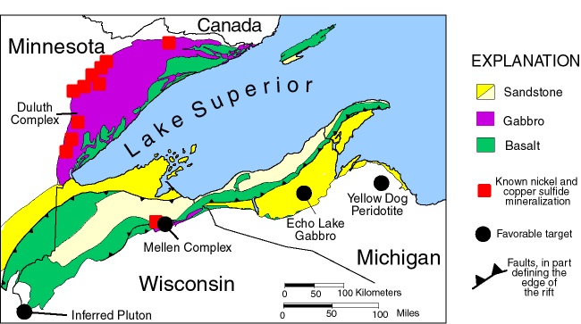
Click on image to see: Western Lake Superior Region: Midcontinent Rift and known Ni-Cu-PGM Sulfide mineralization in Minnesota, Wisconsin and Michigan. Source-USGS
Seattle POST-INTELLIGENCER Reporters Special Report-The Mining Of The West
New York Times-Toxic Waters Series
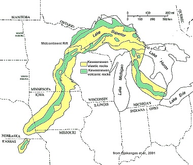
Click on image to see larger view of Midcontinent Rift System
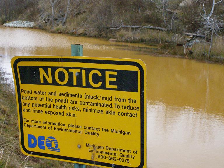
Click on image to see larger view of - Acid Mine Drainage (AMD) from the Buck and Dober Mines pollutes this Michigan river.
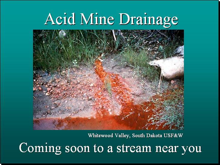
Click on image to see larger view of Acid Mine Drainage (AMD) in Whitewood Creek South Dakota
Arsenic Contamination from Hard Rock Mining -Whitewood Creek-Belle Fourche River, South Dakota
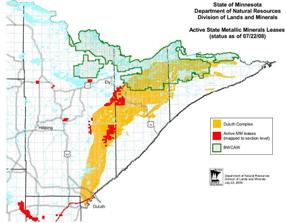
Click on image to see larger view of Active State Leases in the Duluth Complex
Click on image to see larger view of Mining The Arrowhead
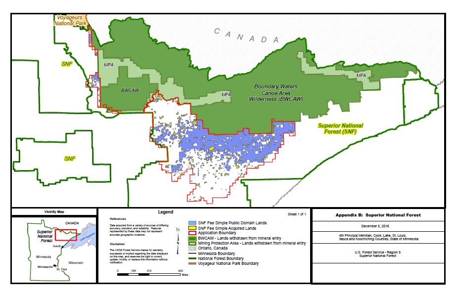
Click on image to see larger view of Superior National Forest Surface and Subsurface Ownership
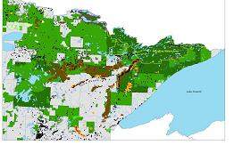
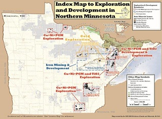
Click on image to see larger view of Map of Mineral Exploration - Northern MN
Map of Mineral Exploration on State Non-Ferrous Leases March 2008 MN DNR
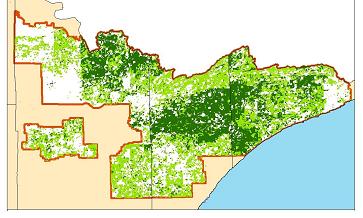
Map of Mineral Rights Ownership in the Superior National Forest and BWCAW
Dr. David M. Chambers on Metal Sulfide Mining - January 2008
Dr. David M.Chambers - "A Position Paper On Perpetual Water Treatment For Mines"
James Kuipers and Sarah Zuzulock "Financial Assurance for Hardrock Mine Cleanup" - Presentation
James Kuipers "Putting A Price On Pollution- Financial Assurance for Mine Reclamation and Closure"
Dr. Thomas Michael Power - "The Economic Role of Metal Mining in Minnesota: Past Present and Future"
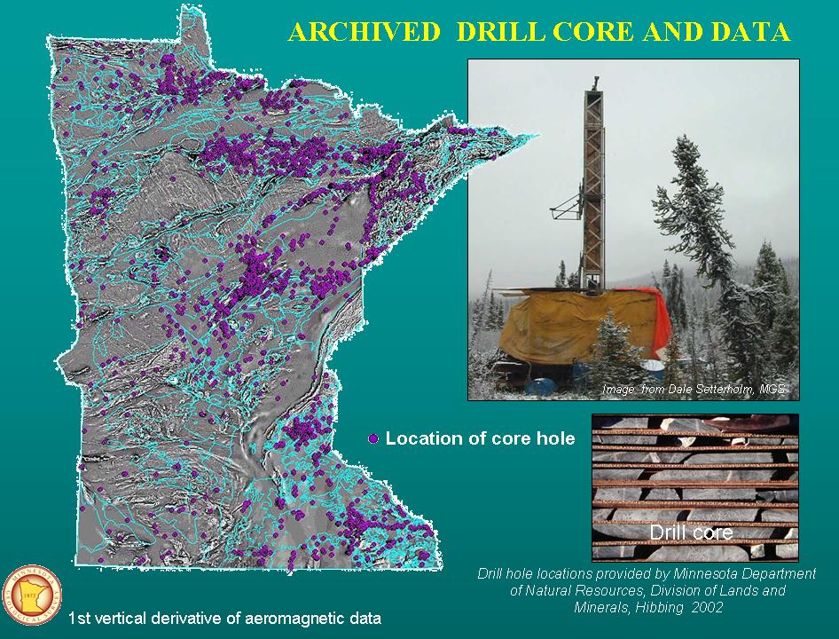
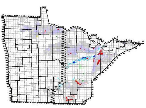
Click on image or HERE to see larger view of Archived Drill Core and Data
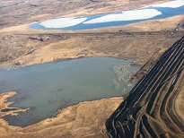
MINING MINNESOTA - The purple dots on this image of Minnesota show drill cores, which indicate the extent to which mining companies are planning to conduct metallic sulfide mining operations in the state.

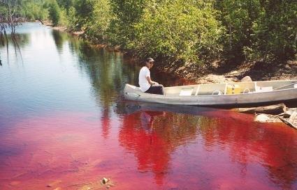
Acid Mine Drainage (AMD) in a Lake
Take Action!
Please call Governor Walz and Lt. Governor Peggy Flanagan and ask them to reject the toxic PolyMet, Teck, and Twin Metals sulfide mines.
The governments highest duty is to protect its citizens. Dangerous sulfide mining poses an unacceptable risk to the waters, wildlife and people of northern Minnesota and should not be allowed in our water rich environment.
Contact the Governor and Lt. Governor at (651) 201-3400
MN Government website linked HERE
Protect our Land, Water, Wildlife and People
Reject Toxic Sulfide Mining!
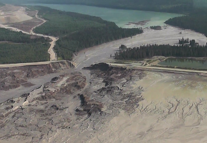
Mount Polley mine disaster, B.C. Canada
____________________
The People vs. PolyMet is a project of the Minnesota Center for Environmental Advocacy Found HERE
Save Our Sky Blue Waters submitted comments with Save Lake Superior Association, the Center For Biological Diversity, Friends of the Cloquet Valley State Forest and the Sierra Club on PolyMet's NorthMet Mine and Land Exchange SDEIS.
Click here for a PDF of our SDEIS comments on the PolyMet project
PolyMet Fact Sheets
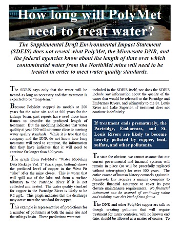
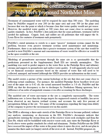
How long will PolyMet need to treat water? and Issues for Commenting on PolyMet's EIS
It's time to put PolyMet on the shelf
By Elanne Palcich
Go Here For Archived Information on the PolyMet Supplemental Draft EIS (SDEIS)
![]() For more recent news, updates, events, alerts and happenings, please join us on Facebook
For more recent news, updates, events, alerts and happenings, please join us on Facebook
For more information on the Northern Campaign to Protect the Arrowhead Region from Sulfide Mining - Go HERE
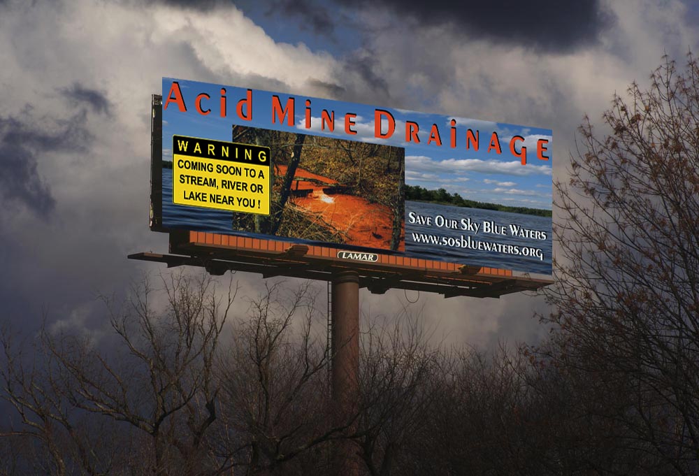
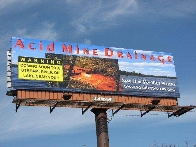 Link: SOS AMD Billboard Image
*******************************
Events and Happenings archived HERE...
*******************************
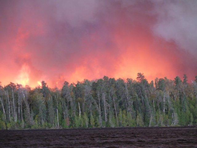
Questions Linger in Aftermath of Pagami Creek Fire - By Elanne Palcich
"Both the public and the U.S. Forest Service need to understand how a lightning strike in a bog near Pagami Creek on August 18 turned into a full-scale conflagration on September 12, burning approximately 1/10 of the Boundary Waters." Found HERE
Streamlining Pollution in Minnesota By Elanne Palcich
"On March 3, 2011 Governor Dayton signed into law legislation designed to streamline the environmental review process. This legislation directly fast-tracks proposed copper-nickel mining in Minnesota." Found HERE
Popping the PolyMet Propaganda Pill By Elanne Palcich
"PolyMet, Inc. is a Canadian company with Swiss ties that is currently undergoing environmental review as it seeks permitting to open the first copper-nickel sulfide mine in the state of Minnesota." Found HERE
USFS Halfway Ranger Station Historic District and "K" Lab near Ely -2010 photo
Kawishiwi Demolition: The Pen and the Bulldozer By Elanne Palcich
"The mine plan as presented on the Duluth Metals website puts the entrance to its proposed underground mine precisely in the location of the Kawishiwi Research Station." Read it HERE...
MINING NEWS AND RELATED ARTICLES
[Archive] Take Action: Protect Water - Stop PolyMet
DNR's public comment period for PolyMet permit to mine open until March 6, 2018
PCA's public comment period for PolyMet permits open until March 16, 2018
Oppose PolyMet's Permits - Tell Minnesota officials to stop this toxic copper - nickel sulfide mine!
More HERE (public comment period is closed)
***
[Archive] Bring a "Prove-it-First" Sulfide Mining Resolution to your 2018 Precinct Caucus!
Minnesota's precinct caucuses will be held Tuesday, February 6, 2018 at 7:00 p.m. More HERE (action closed)
***
[Archive] Take Action - Stop H.R. 3115: PolyMet Land Exchange Bill introduced by Rep. Rick Nolan to fast track destructive sulfide mine in Minnesota's protected Superior National Forest! Click HERE for info (Action closed, bill stalled in Congress)

***
[Archive] Lawsuit Filed to Halt Land Exchange for PolyMet Mine
PolyMet Mine poses an unacceptable risk and will harm Minnesota’s water and environment
March 2017 - Save Our Sky Blue Waters, Save Lake Superior Association, and the Sierra Club North Star Chapter have filed legal action against the U.S. Forest Service (USFS) land exchange with PolyMet. More Info HERE
***
[Archive] Tell the U.S. Forest Service to protect all of Minnesota’s waters and watersheds from Toxic Sulfide Mining!
To Comment on the proposed USFS - Northern Minnesota Federal Mineral Withdrawal EIS - go HERE
Click HERE for more information
(This Comment Period is Closed)
***
[Archive] Nix Twin Metals' Leases – and - Stop PolyMet's Land Swap
Twin Metals Mineral Leases: Tell the U.S. Forest Service and the Governor, protect Minnesota’s waters and forests from toxic sulfide mining! Go HERE (Comment period closed)
***
[Archive] Oppose: H.R. 761: National Strategic and Critical Minerals Production Act - Rep. Nolan votes with Republicans for special favors bill for big mining! Go HERE (Action closed, HR 761 stalled in Congress)

***
[Archive] Reject the Damaging Boundary Waters–School Trust Land Exchange!
The U. S. Forest Service comment period on its School Trust Land Exchange draft Environmental Impact Statement (DEIS) ends on October 10, 2017.
Stop the giveaway of the Superior National Forest being proposed in the name of our school children!
Click HERE for more information (Action closed)
***
[Archive] Reject the Damaging Boundary Waters Land Swap! - It would be Harmful to the Boundary Waters, Superior National Forest and Lake Superior. It’s a Bad Deal for the Nation and Minnesota's School Children, A Good Deal for Mining and Logging - Go HERE (Action closed)
***
[Archive] PolyMet Mine and Land Exchange Final EIS (FEIS) released - Comment period ends Dec. 15, 2015
More information found HERE (This comment period has closed)
***
[Archive] Protect Minnesota's water resources! - Ask for an EIS at the Northshore Mine expansion that will unearth sulfide minerals at their taconite mine! More information on the Northshore Mining Mine Progression EAW - Go HERE (Action closed)
***
[Archive] Mining Doublespeak at the Minnesota Legislature - Sustainable Mining is an Oxymoron - Legislation has been introduced to create a so-called "Sustainable Mining Institute" (HF 2842/ SF 2632). Email or call your legislators in opposition to this bill - Go here for more information (Action closed)
***
[Archive] Comment on Northshore Mining’s pit expansion that will unearth sulfide bearing rock! Public comment period ends August 19, 2013 More info HERE - (Comment period is closed)
***
[Archive] Stop the Boundary Waters Land Exchange!
Representative Cravaack introduces Special Favors Bill for multinational mining corporations that will allow tens of thousands of acres of Federally protected SUPERIOR NATIONAL FOREST lands to be strip mined!
Oppose H.R. 5544: Minnesota Education Investment and Employment Act
Legislation is a Windfall to Foreign Mining Corporations and would Fast Track Turning Minnesota's Beloved Arrowhead into a Toxic Sulfide Mining District
More Info found HERE (Action closed, bill stalled in Congress)
***
[Archive] SOS MINNESOTA WOLVES Stop the hunting & trapping season on wolves in Minnesota More info HERE (Action closed)
***
(Archive) Sled Dog's To St. Paul
Frank Moe's Sled Dog's To St. Paul -found Here
Film Premiere for SLED DOGS TO SAINT PAUL

***
[Archive] Kawishiwi Building Disposition EA USFS - The Forest Service is proposing to eliminate the historic Kawishiwi Research Station and "K" Lab near Ely and the BWCAW. The destruction of these Superior National Forest cultural and scientific landmarks, would pave the way for the impending sulfide mining projects located near the BWCAW. See More Here (Comment period closed)
***
[Archive] Federal Hardrock Mineral Prospecting Permit Draft EIS (EIS) - USFS - Broadscale analysis to address FS consent and BLM issuance of federal hardrock mineral prospecting permits and operating plans (present and future). More Here (Comment period closed)
***
[Archive] Proposed NorthMet Mining Project and Land Exchange EIS Scoping - The Superior National Forest is currently developing scoping materials for the land exchange portion of the PolyMet Mine Project. There is a 45 day comment period, which was noticed in the Federal Register: October 13, 2010 More HERE (Comment period closed)
***
[Archive] Send PolyMet To Summer School -More HERE (Action closed)
***
[Archive] PolyMet's NorthMet Mine Draft Environmental Impact Statement (DEIS) released - Public comment period ends February 3, 2010 More HERE (Comment period closed)
***
[Archive] Support the "Safe Mines To Protect Our Water" Bill. House Bill: HF0916; Senate Companion: SF0845 More HERE (Bill has been withdrawn)
***
[Archive] Oppose Rep. Oberstar's HR 4292, Senators Klobuchar and Coleman's S 3411 Superior National Forest Land Adjustment Act of 2007 and 2008 More HERE (Bill has stalled and died in Congress)
Click Here to See VIDEO Archives
Minnesota Joint Legislative Hearing on metallic sulfide mining - Video
Dr. David Blowes on Acid Mine Drainage remediation at UMD - Audio
WWW.SOSBLUEWATERS.ORG
![]() For more news, updates, events, alerts and happenings, please join us on Facebook
For more news, updates, events, alerts and happenings, please join us on Facebook
![]()
Save Our Sky Blue Waters is a 501(c)(3) non-profit organization dedicated to protecting the waters, forests and wildlife of our region.
The Arrowhead region has been known as one of the most magnificent areas of the state, for its majestic forests, wetlands, and waters and because it contains the headwaters of three great watersheds--north to Rainy River, east to Lake Superior, and south to the Mississippi.
The protection of these valuable resources is our organization's core mission.
Help - Take Action!
________________________ Wisconsin "Prove it First" Law Answer: Wisconsin Sulfide "Mining Moratorium Law" (Act 171) Minnesota "Prove It First" Sulfide Mining Moratorium Petition "Prove It First" Caucus Resolution found HERE "Prove It First" Petition to print Archive - Petition to oppose PolyMet's Superior National Forest Land Adjustment Act Jim Hall's Music Video
"PolyMet to Wild Rice" An Open Letter To PolyMet Jim Hall on You Tube Marc Fink - Our Own APPALACHIA Sara Thomsen - Precious Water (We Don't Want Your Mine) Jane Reyer - Beware Hidden Costs of Mining Ventures Hear Bob Tammen on KDAL's "Common Sense" A Woman's View of the PolyMet DEIS by Elanne Palcich Counterpoint by Elanne Palcich In Minnesota, the price of metals is damage to our water
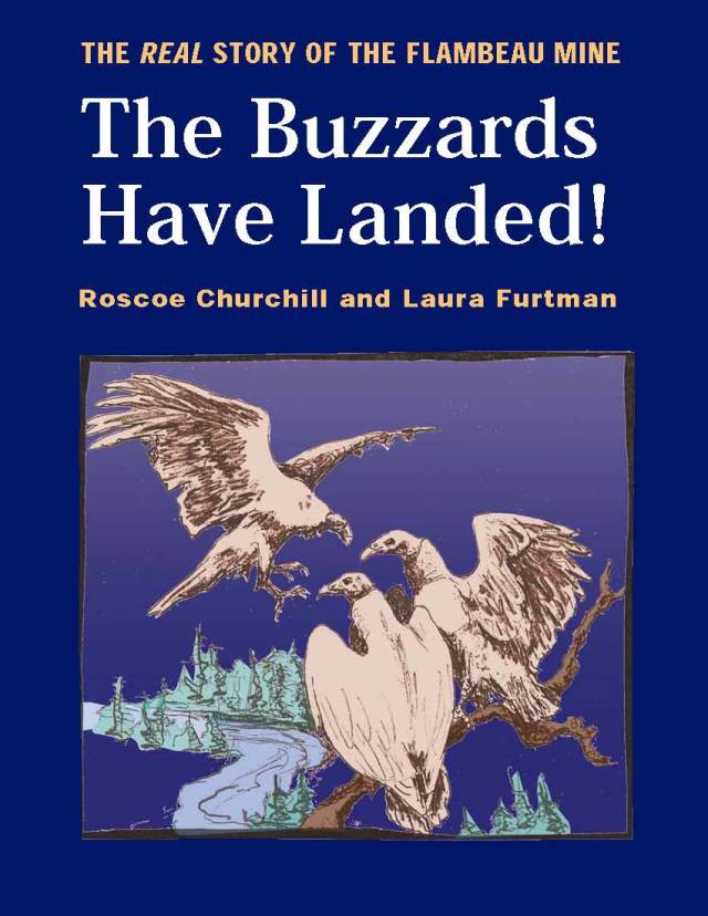
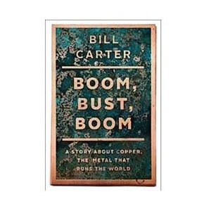
By C.A. Arneson - MinnPost.com Is anyone protecting Minnesota's waters? C.A. Arneson - MinnPost Len Anderson - Wild Rice and Sulfates & PolyMet's sulfide mine Len Anderson - The Validity of the Minnesota Wild Rice Sulfate Standard Robert DesJarlait - Corporate Personhood and Sulfide Mining in Anishinaabeg Country EPA's Ken Westlake Explains Very Negative Environmental Rating For PolyMet Mine Project-UpTake EPA's Ken Westlake Explains Very Negative Environmental Rating For PolyMet-UpTake Transcript Minnesota's Arrowhead: The Last Frontier, by Elanne Palcich The Buzzards Have Landed ! The Real Story of the Flambeau Mine, by Roscoe Churchill and Laura (Furtman) Gauger WMAN - the Western Mining Action Network "Boom, Bust, Boom - A Story About Copper" by Bill Carter Click on image for Dr. Tom Power's The Economic Role of Metal Mining in Minnesota: TRUST, the documentary Trust - The Fight for Water & Treaty Rights in the Great Lakes Sulfide Mining District planned for Minnesota's Arrowhead Region Mines and Communities - Global GLIFWC - Great Lakes Indian Fish and Wildlife Commission Click here to see archived Great Lakes related news. Save Lake Superior Association Minnesota Center For Environmental Advocacy Center For Biological Diversity Friends of the Cloquet Valley State Forest Friends of the Boundary Waters Indigenous Environmental Network Izaak Walton League of America MINNESOTA DIVISION
Minnesota Environmental Partnership Wisconsin Resources
Protection Council - WRPC Sierra Club - John Muir Chapter Bad River Watershed Association Northern Alaska Environmental Center Indigenous Environmental Network CENTER for SCIENCE in PUBLIC PARTICIPATION - CSP2 Center For Biological Diversity The Canary Research Institute on Mining Environment and Health Earthworks Hardrock Mining: Acid Mine Drainage, Fact sheet EPA-What is Acid Mine Drainage? GLIFWC - Sulfide Mining: The Process And The Price Sierra Club - PolyMet "Prove It First" facts on PolyMet Project FOBW - Sulfide Mining Overview MN-METALLIC SULFIDE MINING "A RISKY PROPOSITION" MN-METALLIC SULFIDE MINING ENVIRONMENTAL IMPACTS MN IKES Walter J. Breckenridge Chapter Sulfide Mining Resolution Northern Alaska Environmental Center The Problem-ACID MINE DRAINAGE Fact Sheet Mineral Policy Center/Earthworks Report-Six Mines, Six Mishaps Mining Law Threatens Grand Canyon, other Natural Treasures Say No To Sulfide Mining in U.P. Trouble On The Yellow Dog Plain Sulfide Mining In Michigan Wolfpack Research National Wildlife Federation Sulfide Mining in MI's UP-A Threat To Waters, Landscapes and Wildlife National Wildlife Federation Metallic Sulfide Mining Impacts On Michigan Wildlife National Wildlife Federation Acid Mine Drainage: A Threat To Michigan's Water Quality Acid Mine Drainage in British Columbia Canada Between a Rock and a Hard Place Eagle Mine Case Study-Schultz Hardrock Mining: Risks To Community Health Predicting Water Quality Problems at Hardrock Mines-Final Report James Kuipers & Ann Maest Predicting Water Quality Problems at Hardrock Mines-Earthworks White Paper Summary Comparison of Predicted and Actual Water Quality at Hardrock Mines- Presentation HEALTH & ENVIRONMENTAL EFFECTS OF TRACE ELEMENTS IN METAL-MINING WASTES - CSP2 Examples of Modern Mines that Damaged Rivers and Fisheries Hardrock Mining On Federal Lands Risk Management Criteria For Metals At BLM Mining Sites BLM- Abandoned Mine Lands(AML) Program At-A-Glance BLM- Abandoned Mine Lands PORTAL EPA-Management and Treatment of Water from Hard Rock Mines EPA-TECHNICAL DOCUMENT ACID MINE DRAINAGE PREDICTION EPA-EXTRACTION AND BENEFICIATION OF ORES AND MINERALS- Copper EPA-Summitville Mine, Colorado Federal Superfund Site EPA-Gilt Edge Mine, South Dakota Federal Superfund Site EPA-Libby Montana Asbestos
Federal Superfund Site REMEDIATION MEASURES AT THE ZORTMAN/LANDUSKY MINE SITES Acid Drainage Technology Initiative (ADTI) Acid Drainage: Abandoned Mine Reclamation, Pennsylvania - DEP Dr. David Blowes - Canada Research Chair in Groundwater Remediation Groundwater Geochemistry and Remediation, Dr. David W. Blowes Dartmouth Toxic Metals - Superfund Research Center Mine wastes: Characterization, Treatment, and Environmental Impacts EPA's "Mining Waste Scientist to Scientist Meeting" June, 2000 Acid Mine Drainage and Effects on Fish Health and Ecology Readings and References in Mining - www.colorado.edu Montana DEQ - PRIORITY Hard Rock Mine Sites EPA and Hardrock Mining: Report January 2003-Maintext EPA and Hardrock Mining: Hydrology-Appendix A EPA and Hardrock Mining: Receiving Waters-Appendix B EPA and Hardrock Mining: Characterization of Ore, Waste Rock and Tailings-Appendix C EPA and Hardrock Mining: Effluent Quality-Appendix D EPA and Hardrock Mining: Wastewater Management-Appendix E EPA and Hardrock Mining: Solid Waste Management-Appendix F EPA and Hardrock Mining: Aquatic Resources-Appendix G EPA and Hardrock Mining: Erosion and Sedimentation-Appendix H EPA and Hardrock Mining: Wetlands-Appendix I EPA and Hardrock Mining: EPA Responses to Comments on Draft Source Book-Appendix J EPA - ABANDONED MINE SITE CHARACTERIZATION and CLEANUP HANDBOOK Lick Run Watershed-Pennsylvania Acid Mine Drainage (AMD) EPA 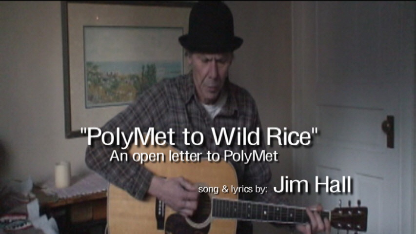

Found HERE
Past, Present, and Future